
Field Varve Measurement
Varve chronology got its start in Sweden and in North America with the field measurement of varve thicknesses and this is still a method that is used today, however, we recommend measuring varves in a lab from outcrop cores if exposures lend themselves to core collection. Outcrop measurements should only be considered where exposures are dry enough to easily discern summer and winter layers and when an outcrop is just not accessible enough for core collection. Cores must be carried out of the field and this may be difficult over long distances.
Measurement of a varve section should begin with the bottom to top counting and staking of varves. This will allow you to become familiar with the intra-annual stratigraphy of varve couplets in the section, will provide an annual scale, and will begin to clear the outcrop surface for accurate measurements. In our work staking the outcrop every 10 years with a nail and orange tape showing the varve count has worked well. An initial varve count improves accuracy tremendously and helps keep track of position in the sequence. Actual measurement should be done on vertical faces from the bottom to the top of the outcrop. Working upward eliminates the burial of lower slope exposures prior to measurement. It is often difficult to measure both summer and winter layer thicknesses in addition to annual layer thickness and we recommend having two people, one to measure and one to record information.
A more elaborate scheme for measuring outcrops was used by Antevs and De Geer. Large vertical faces were cleared and shaved to expose the varves for measurement. A waterproof tape, one that did not expand or contract with moisture, was pinned to the outcrop and the boundaries of summer and winter layers were marked on the tape. Actual varve measurements were done on the tapes in a lab.
Preparation
Staking a section with nails and tape (every 10 years) is an easy way to prevent errors and to make decisions on annual layers before having to make measurements. After the section is staked, the varves will be successively measured on vertical faces.
The next step is to cut vertical faces from which true annual layer thickness can be measured.
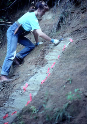
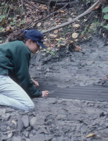
Left: Sharon (Zaboly) Kelly at site MER1, Merrimack Valley, Concord, NH. Right: Sarah (Brown) Lewis at site PAS1, Passumpsic Valley, East Barnet, VT.
Measurement
Gerard De Geer and Ernst Antevs used tapes pinned to a vertical face on the outcrop to record winter and summer layer thicknesses.
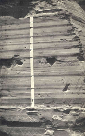
Image from Antevs (1922) shows a taped outcrop at Hanover, NH (loc. 67 of Antevs, 1922).
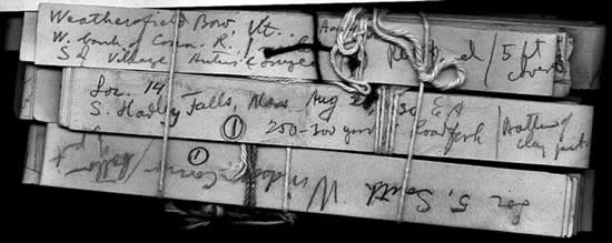
Some of Antevs' original outcrop tapes that are housed at the Antevs Library at the University of Arizona. Tapes are shown from South Hadley Falls, Mass. (loc. 14, Antevs, 1922), South Windsor, Conn. (loc. 5 of Antevs, 1922), and Weathersfield Bow, VT (unpublished). Image courtesy of Owen Davis (Librarian, Antevs Library, Univ. of Arizona).
Graphing
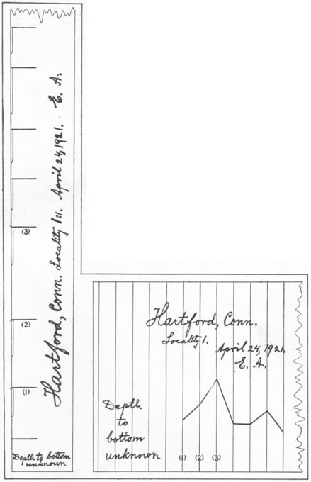
Tapes from an outcrop were then converted to graphical data as shown by this figure from Antevs, 1922. The tape strip measured on April 24, 1921 (left) and plot (right) are of NE varves 3001-3007 at Hartford, Conn. (loc. 1 of Antevs, 1922). Antevs plotted his varve records from left to right, which has become the norm in North America. De Geer, and varve chronologists in Sweden, plotted records from right to left, which is still the case today.
The images below show some of Antevs 1:1 tracing paper plots of varve thickness from tapes pinned to outcrops. Many of the notations on these plots are in Swedish.
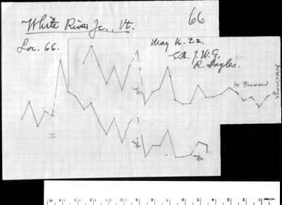
Part of a plot of varves from White River Junction, VT (loc. 66 of Antevs, 1922 that covers NE varves 6783-6888). The outcrop was measured on May 16, 1922 and Antevs (E.A.) was assisted by Joseph Goldthwait (J.W.G.) of Dartmouth College and Robert Sayles of the Harvard University Museum. Image courtesy of Owen Davis (Librarian, Antevs Library, Univ. of Arizona).
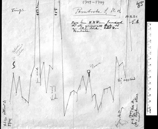
Part of plot of varves from Pembroke, NH (loc. 45 of Antevs, 1922) in the Merrimack Valley. The outcrop was measured on September 10, 1921 by Ernst Antevs (E.A.) and spans NE 5705-5749. Image courtesy of Owen Davis (Librarian, Antevs Library, Univ. of Arizona).